
Voorhees Previous Residents Sources
Past-resident research starts with the period in question. Current parcel data identifies the modern property, while the county recorder supplies the recent deed layer. Older transfers and household clues move to archives, library microfilm, and historical-society collections. Those sources have different scopes. A countywide deed can identify a property transaction, while a Camden City directory can be a valuable lead without proving that its listed address was in Voorhees. The table separates the documented coverage from conclusions about who lived at an address.
| Source | Years it covers | Where held | What it can show |
|---|---|---|---|
| Camden online property records | 1978 to present | Camden County Clerk and online index | Recorded instruments, party roles, dates, legal descriptions |
| Camden deed books and indexes | Deeds 1844–1900; indexes 1844–1912 | New Jersey State Archives guide | Earlier grantor-grantee and title leads |
| Camden City directory reels | 1863–1947, with stated gaps | Camden County Library | Historical directory clues and city scope |
| Federal census microfilm | 1850–1930 at the library | Camden County Library | Household and geographic context for a census year |
| Local records and parcel data | Depends on the record | Voorhees and Camden County offices | Address continuity and specific property history |
Begin with the tax and GIS records if the address is known today. Start with the recorder if a recent transfer is known. For a nineteenth-century trail, the State Archives and local repositories take priority because the web index does not cover that era.
Voorhees Address Continuity Clues
The present-day address is only one label for a property. The Camden County Tax Data Hub can search by owner, property, B.L.Q., class, sale date, sale price, building square footage, and year built. Its visible import date was August 27, 2026. The Camden GIS viewer adds address, street, block and lot, owner, and PIN search modes. Together they help anchor a historic reference to a modern parcel without claiming that an owner, mailing address, or deed party is a current resident.
A parcel ID or block and lot can be more stable than a street number. Preserve the exact address from a source first, use the USPS lookup to normalize the current mailing form, then verify the parcel in GIS and compare it to the assessment and deed descriptions. Postal place names, situs addresses, and owner mailing addresses serve different jobs. Treat them as separate facts in the research notes.
The Tax Data Hub is shown in this property-history screenshot. Its filters can narrow a parcel match before a deed chain is attempted.
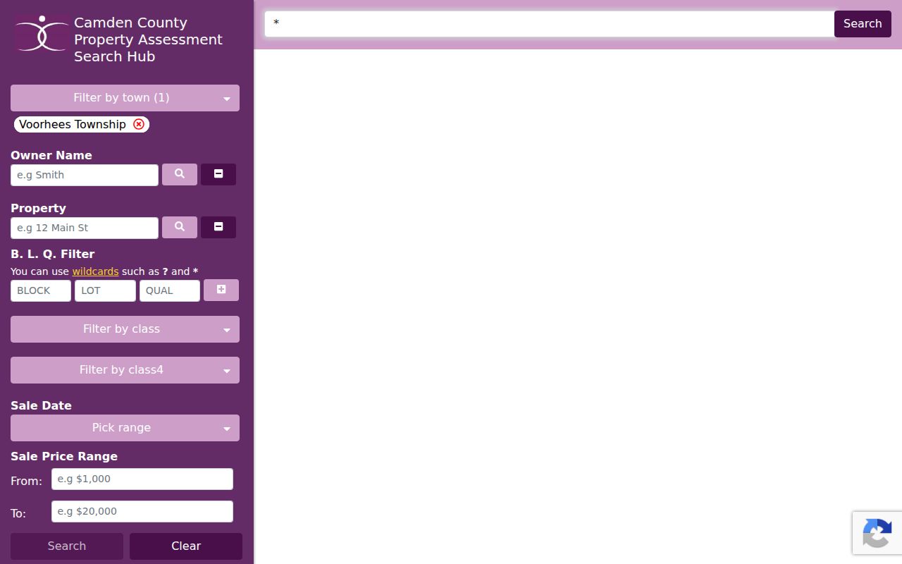
The assessment layer gives the current parcel context, while the title chain and historical collections carry the research backward.
The Camden County GIS viewer is the source for this parcel screenshot. It connects an address, street label, block and lot, and PIN without converting the map into a list of people.
Use the selected parcel and property-card details as continuity clues, especially when the street label found in an older source is uncertain.
Trace Voorhees Deed Chains
Camden Search Anywhere is the modern recorder route. It offers party-name, document-type, town, date, consideration, instrument, book and page, block and lot, legal-description, map, district, parcel, case or parcel, and PIN-style searches. County online records begin in 1978. A deed chain is most reliable when each instrument is tied to the same parcel or legal description, not merely a similar street address or surname.
- Confirm the current parcel, block and lot, and legal-description clues through GIS and the assessment record.
- Find the current owner’s acquisition instrument in the recorder index and save the instrument number, recording date, town, and party roles.
- Use the seller or prior party as a search lead to locate the earlier acquisition, while checking that the parcel or legal description still matches.
- Repeat the comparison backward. Read linked documents and statuses before treating a result as final.
- When the chain reaches before 1978, move to the Archives guide, CCHS, or the Clerk’s historical access route rather than assuming a missing web result ends the chain.
- Grantor and grantee
- The grantor transfers an interest in a recorded instrument; the grantee receives it. The roles can change from one deed to the prior deed.
- Chain of title
- A sequence of transfers connected by the same property identity. It traces ownership interests, not every person who lived there.
- Legal description
- The parcel description recorded in an instrument. It can be more durable than a street label when addressing has changed.
Keep the document sequence and parcel match beside each result. That small record trail makes it possible to separate a confirmed transfer from a surname match that belongs to a different property.
Camden Deed Record Corrections
Recorder results can include direct and indirect party labels, reference fields, linked documents, and an instrument number. The status labels matter. In the observed Camden system, R means replaced and C means correction. Follow the linked documents before deciding which row closes a title question. An index row, a scanned image, and a certified copy are different evidence levels, and images or print functions may require an account.
The Camden County online property-records portal is a route to the 1978-present index. If a record requires formal confirmation, contact the Camden County Clerk rather than treating a search export as a certified copy.
Note: A replacement or correction can explain conflicting search rows, but it does not by itself explain every change in ownership or occupancy.
Before Voorhees Was Voorhees
Jurisdiction is part of an address history. Camden County’s history records that the county was created from Gloucester County on March 13, 1844. Earlier property or family records may therefore use Gloucester County series. Voorhees separated from Waterford Township on March 3, 1899, so an older local reference can appear under Waterford rather than the modern township name. These are search terms to test, not proof that a particular property lay in each jurisdiction.
Camden County’s history page is the source for this historical-jurisdiction screenshot. It explains why a pre-1844 deed trail may require a different county search.
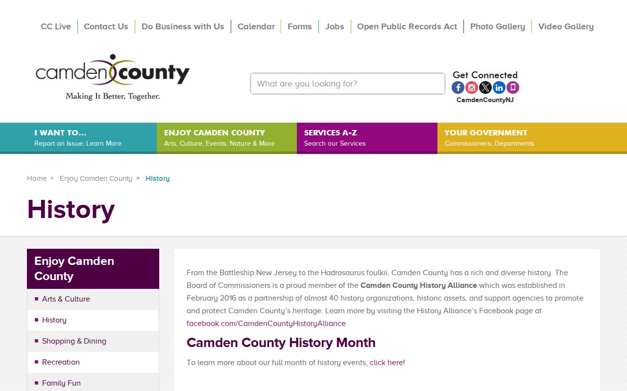
A historical county label is a filing clue. The parcel, record date, and source wording still need to be reconciled.
Voorhees Township’s history is shown in this source image. Its Waterford separation detail helps explain why past-resident research can require a pre-1899 township term.
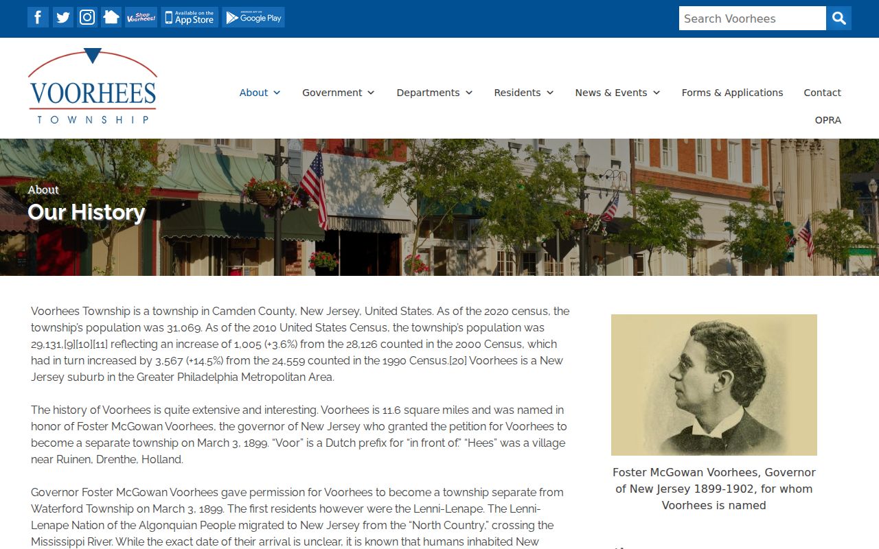
Use the historic place name alongside the modern one, then record which term produced a result instead of blending the two labels.
Voorhees Previous Residents Archives
The New Jersey State Archives Camden deed guide covers Camden deeds from 1844 to 1900 and indexes from 1844 to 1912. It is the documented bridge once the online recorder period ends. CCHS adds original Camden deeds, including some that were never recorded, alongside directories, newspapers, maps, church records, yearbooks, WPA materials, cemetery records, and other collections. One source can lead to another, but no single layer should be represented as exhaustive.
The Camden County Historical Society Research Library describes nearly 100,000 resources. Research visits are by appointment on Wednesday and Friday from 10:30 to 2:30; members are free and nonmembers are listed at $5. Staff research can take three to six weeks. A request with a precise name, date, and location is easier to scope than an open-ended search, and the staff’s response remains a repository finding rather than automatic proof of an address occupant.
Voorhees Past Household Pairing
Ownership is only one piece of who lived here before. The Camden County Library genealogy collection lists 25 reels of Camden City directories from 1863 through 1947, Camden County telephone directories from 1960 to the present, federal census microfilm from 1850 through 1930, Courier Post microfilm from October 1949 to the present, and online current obituaries back to 1999. The city-directory reels are mainly Camden City material, so their geography must be transcribed exactly rather than assumed to be Voorhees.
- Find the closest available directory or telephone-book year and transcribe the full title, year, reel or page, place scope, name, and printed address.
- Check the adjacent available edition for the same address or household clue, marking an absence as an absence rather than a move.
- Pair the directory era with the available census microfilm to test household, age, and geographic context for that census year.
- Use newspaper, obituary, cemetery, or naturalization references as dated leads, and preserve the publication or collection citation.
Historical directory holdings, reels, and access details belong with the city directories collection. Here, the value of a directory is its place in a single address trail, where it is compared with a deed, parcel, or census source instead of being treated as current-resident proof.
Voorhees Directory Gap
The Camden City directory runs have explicit gaps, including 1868, 1871, 1873, 1918–19, 1932–39, 1941/42, and 1944–46. The 1932–39 gap is a practical reminder that a missing book is a source limitation, not evidence that a person left an address. The same caution applies to a name absent from a city-scoped volume or an unindexed archival image.
When a directory year is missing, use the nearest available edition and look for a deed, newspaper, census, cemetery, or CCHS collection that is dated within the interval. Cite the gap directly in notes so the next researcher understands why the trail has no annual entry.
Limits on Voorhees Past Residents
Directory, census, deed, court, and property records are historical evidence with limits. They do not prove a living person’s current location, and they can carry a household head, business, mailing address, party role, or historical spelling rather than a complete household. The aim is a documented house-history or family-history trail, with each fact tied to a source and time period.
New Jersey Courts’ public-access record guidance is shown in this official screenshot. Court materials have their own access, sealing, and copying rules, so they should not be repurposed as an address directory.
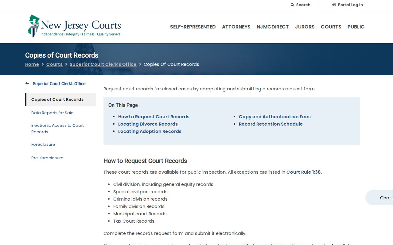
The image reinforces the source-by-source approach: a public index may help locate a record, while access to a fuller document can be restricted or require a custodian request.